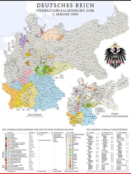
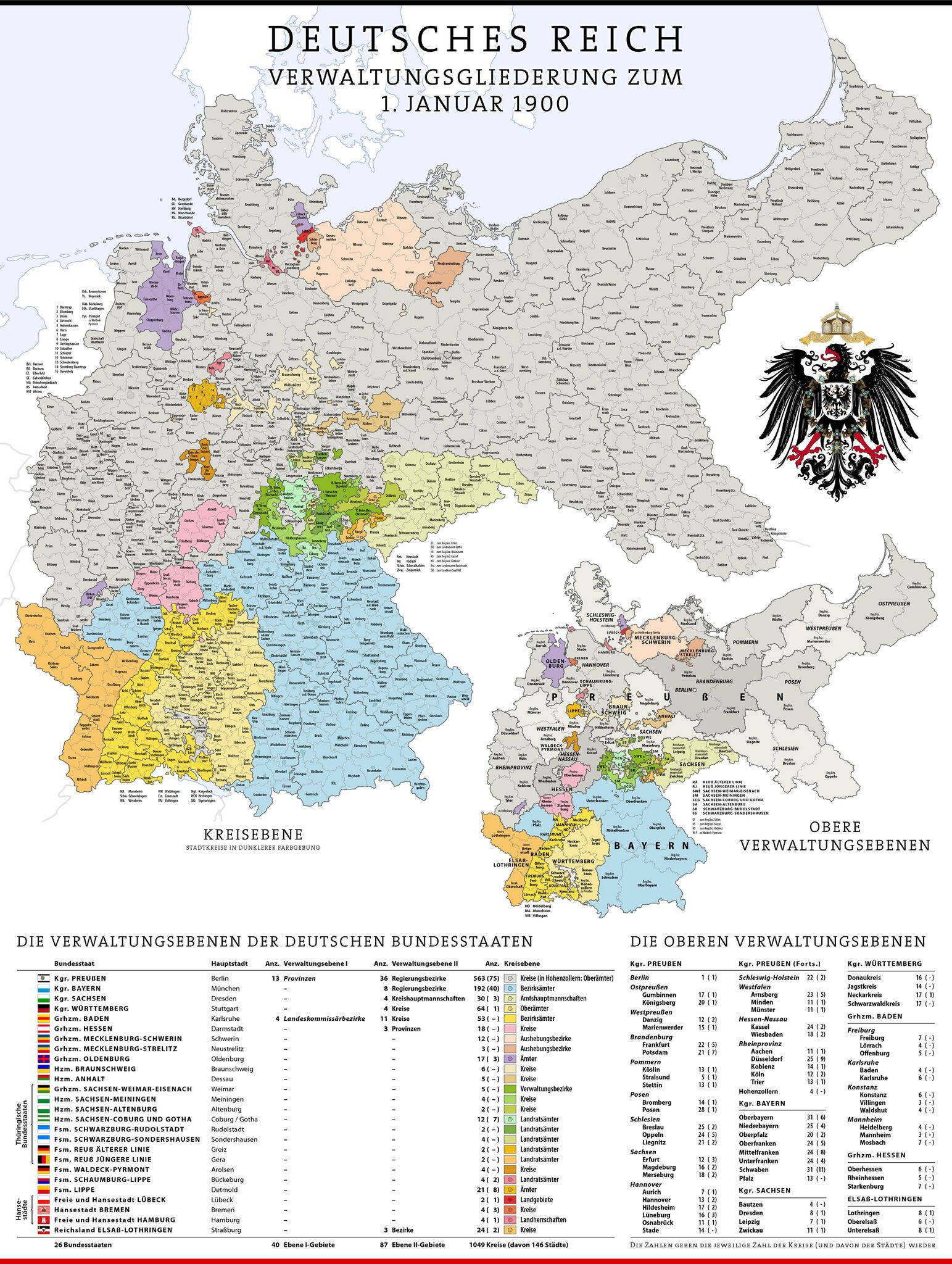
Bestand:Karte Deutsches Reich, Verwaltungsgliederung 1900-01-01.jpg
Uit Wiki Raamsdonk

Grootte van deze voorvertoning: 452 × 600 pixels. Andere resoluties: 1.543 × 2.048 pixels | 5.013 × 6.654 pixels.
Oorspronkelijk bestand (5.013 × 6.654 pixels, bestandsgrootte: 3,47 MB, MIME-type: image/jpeg)
Beschrijving
Importing file
Bestandsgeschiedenis
Klik op een datum/tijd om het bestand te zien zoals het destijds was.
| Datum/tijd | Miniatuur | Afmetingen | Gebruiker | Opmerking | |
|---|---|---|---|---|---|
| huidige versie | 12 jul 2024 12:59 | | 5.013 × 6.654 (3,47 MB) | Maintenance script (overleg | bijdragen) | == Beschrijving == Importing file |
U kunt dit bestand niet overschrijven.
Bestandsgebruik
Dit bestand wordt op de volgende pagina gebruikt:
